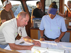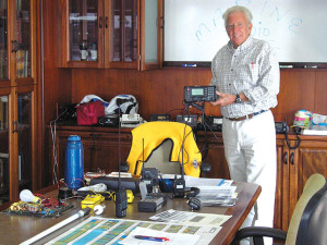
Navigation, Radar, and Marine Radio courses help sailors develop skills for coastal navigation, using and fundamentals of marine radar, and marine radio to find a safe route to a destination using landmarks in day and night.
- Coastal Navigation 1
- Coastal Navigation 2
- Coastal Navigation Certification
- Celestial Navigation
- Best Practices for Electronic Chart Systems
- Introduction to Marine Radar
- Marine Radar for Cruising
- Marine Radio Operator’s Course
Coastal Navigation 1
 A great course for boaters new to navigation, students planning a first cruise to Catalina and students needing a refresher before taking the USCG Licensing course. While the skills of coastal navigation, have evolved over the years, the basic goal is still to determine your position and to find a safe route to a destination using landmarks, both natural and man-made, as reference points. Class begins with an introduction to charts and plotting tools. By the second week, you will be finding latitude and longitude, determining distance and direction. Other topics include plotting, time/speed/distance calculations, compass and compass error, bearings, positioning and running fixes. This course has a strong emphasis on practical skills and students should expect one or two hours of homework per week.
- Prerequisite
- None
- Text & Materials
US Sailing Coastal Navigation, Chart 18746, Chart TR1210 and plotting tools.
- navigation dividers
- course plotter or parallel rulers
- mechanical pencils
- soft eraser
- pocket calculator or nautical slide rule.
You can purchase these items at The Lazarette.
- Successful completion prepares you for:
- Coastal Navigation 2
Check for upcoming classes and Register online >
Coastal Navigation 2
In this course we will be covering new topics while using our basic skills from Coastal Navigation 1- Plotting Latitude & Longitude, Course & Distance, DR, Compass Error, and more. New topics will include Set & Drift, Tide/Current Calculations and Voyage Planning. The last evening will focus on GPS, GPS chart plotters, creating waypoints and routes.
- Prerequisite
- Coastal Navigation 1 or equivalent experience using paper charts for navigation
- Materials
- US Sailing Coastal Navigation, Chart 18746, Chart TR 1210 and plotting tools
- Successful completion prepares you for:
- Coastal Navigation Certification
Check for upcoming classes and Register online >
US SAILING Coastal Navigation Certification – contact us for information on challenging this certification level
This course is currently available only for self study for students with prior navigation experience seeking a US SAILING Coastal Navigation Certification.
Please call The School Office at 949-645-9412 for more information.
- Prerequisite
- Coastal Navigation 1 recommended. It is expected that students have knowledge of basic chart work, variation/deviation problems, aids to navigation, relative/true bearings and know how to use Chart #1, Coast Pilot and a Light List.
- Materials
- Coastal Navigation
Check for upcoming classes and Register online >
Celestial Navigation
We have come to rely on satellites and electronic navigation, but the complete seaman is still adept at the art of celestial navigation. This class is devoted to the basics of celestial navigation and principal trans-oceanic navigational skills. You will learn to navigate utilizing the sun, sextant, chronometer and tables.
You will learn to calculate sailings to determine the best trans-oceanic route to take, use and read a sextant to measure altitude of the sun & stars, take noon sights, and take lateral sights (Azimuth) to check your vessel’s compass deviation. Then you will take the sighting information and learn how to translate that reading into a line of position.
Six classroom meetings, two field trips to practice hands-on use of the sextant and chronometer each followed by a workshop to complete plotting and work from the field trip.
- Prerequisite
- Coastal Navigation 1 or equivalent experience
- Text & Materials
- : Nautical Almanac 2023, Navigation tools (roll plotter, triangles, dividers, compass, etc.), Calculator, Chart 18746
Check for upcoming classes and Register online >
Best Practices for Electronic Chart Systems
one evening seminar to introduce students to electronic navigation principles and practice. Using the charting system called Navionics and given a scenario, students will engage in Voyage Planning first with auto-route and then manually. Next, you will adjust the many filters and options within Navionics to prepare the electronic chart display for effective voyage monitoring. The principles and practices learned in this course are applicable to any electronic chart system. Learning outcomes include moving between electronic and paper charts, updating e-charts, raster versus vector e-charts, creating waypoints and routes, choosing overlays including aids to navigation, weather, radar, and how to gauge system accuracy and reliability. Students are encouraged to bring their own devices to class, pre-loaded with Navionics and the charts for our local area. Loaner I-pads with Navionics will be available.
Class size: Min 5 – Max 10 students
- Prerequisite
- No prior experience required.
Check for upcoming classes and Register online >
Introduction to Marine Radar
A fast but informative familiarization with Marine Radar. We will look at quick ways to assess risk of collision, tips on using the Radar to Navigate in the fog, and the fundamentals of how the radar works. We will explore fundamental principles and then practice quick ways to detect a dragging anchor using radar ranges and to assess risk of collision by observing changes in bearing and range. This course will help a novice to make good use of radar to improve situational awareness.
- Prerequisite
- No prior experience required. Coastal Navigation 1 recommended
Check for upcoming classes and Register online >
Marine Radar for Cruising
A course designed for cruisers who want to make the most of their radar. Competencies include use of rain and sea clutter to fine tune the radar picture, use of radar scales to see large and small vessels in time to act, determining a target vessel’s bearing and range at the Closest Point of Approach (CPA), and choosing an alteration of course that will open CPA while making the course change readily apparent to other vessels. This course will include piloting/navigating by radar ranges and best use of radar in low visibility. It will include the use of paper maneuvering boards to work out relative motion and CPA.
- Prerequisite
- Coastal Navigation 1 recommended
- Text and Materials: USCG Navigation Rules & Regulations Handbook recommended, but not required.
Check for upcoming classes and Register online >
Marine Radio Operator’s Course

Taught by world renown Ham Radio Operator and Radio Instructor Gordon West, this one-day licensing class covers Federal Communications Commission (FCC) Marine Radio rules and regulations, communication procedures, equipment operations and other radio equipment on vessels. West brings in live radio equipment, including Class D DSC VHF radios, live Single Sideband, AIS live receivers, DSC 25-Watt radios for programming, handheld radios for MMSI programming, and associated antennas for all! Also see and hear EPIRBS, overboard alert devices, GPS systems, and small radio trackers.
The FCC MROP is required to operate radio equipment aboard compulsory equipped small passenger vessels in harbors and at sea. A copy of this license must be posted onboard Coast Guard inspected vessels, and the license is a required prerequisite for virtually all other FCC commercial licenses including GROL, GMDSS and marine Radiotelegraph licenses. Additionally, this license is recognized by Foreign Countries who requires a Marine Radio Operator Permit for charters in their jurisdiction.
The FCC Marine Radio Operator’s Permit (MROP) exam will be given in class. A passing grade will result in the lifetime FCC MROP license.
Mariners may need a Marine Radio Operator’s Permit if they:
- Carry more than six passengers for hire;
- Have a vessel radio operating on medium or high frequencies;
- Sail to foreign ports, or
- Are on a vessel larger than 300 gross tons and are legally required to have a radio.
Gordon West is a certified State of California Vocational instructor, teaching for more than 40 years. His students have traveled all over the world using their radio licenses
- Prerequisite
- You must be a legal resident or eligible for employment in the United States and be able to receive and transmit spoken messages in English.
- Two types of ID required (driver’s license, passport, social security card, TWIC card, etc). Bring both to class.
- Text & Materials
- West’s study notes
- Exam Fee: $40 CASH payable to the instructor at the time of examination. An FCC administration fee will be due to the FCC approximately 2-weeks after the test – you will receive an email from the FCC.
Check the schedule for upcoming classes and Register Online >
